Y Ty and Things to fo
Y Ty is a small commune in Bat Xat District, Lao Cai Province, located about 70 km northwest of Sapa. Perched at over 2,000 meters altitude, with the Nhui Co San mountain range behind it, Y Ty feels like a hidden world above the clouds. The region is home to several ethnic groups, including the Ha Nhi, Mong, and Dao, whose traditional ways of life remain largely untouched by tourism.
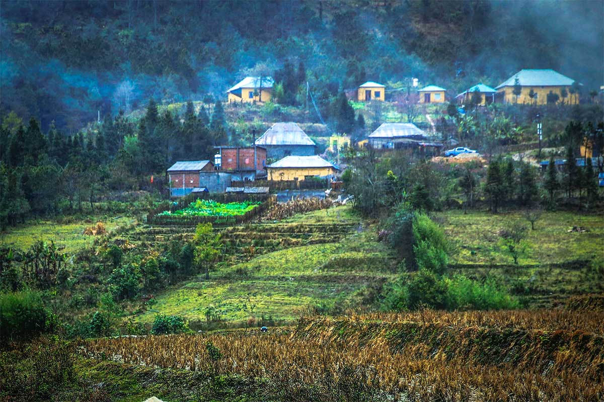
The real charm of Y Ty lies in its raw nature and authentic mountain life. Expect remote villages, winding mountain roads, and terraced rice fields that stretch across steep hillsides. Unlike Sapa, you won’t find big hotels or tour agencies here—Y Ty is all about slow travel, immersion, and exploration.
1. Going Off the Beaten Track
Y Ty is the definition of off the beaten track. Whether by motorbike or car, the joy of being here is simply exploring the landscape—passing through quiet villages, winding roads, and vast rice terraces without encountering crowds. Every turn offers another viewpoint or glimpse of daily mountain life.
2. Learn About Ethnic Cultures
Meeting the ethnic communities is one of the most rewarding experiences in Y Ty. You can visit traditional Ha Nhi villages with their distinctive mushroom-shaped earthen houses or stay in a family-run homestay to experience local hospitality firsthand. Markets, village visits, and conversations over home-cooked meals offer a real insight into their lives.
3. Cloud Hunting

Y Ty is famous for its seas of clouds, especially between September and April. Mornings often reveal valleys filled with thick clouds while the sun shines on the mountain peaks—a dreamlike scene that attracts photographers and travelers looking for something magical.
4. Trekking
Trekking in Y Ty is possible but more challenging compared to Sapa. There are no well-established trekking routes or local trekking guides readily available, so hikes here are more about self-guided exploration or arranging a guide in advance who knows this region specifically. The reward is solitude and pristine landscapes rarely seen by others.
Villages and minorities in Y Ty
The entire municipality has a total of nearly 800 households in 16 villages with 4 ethnic groups: the Mong, Ha Nhi, Dao and Kinh, whose poverty rate is still very high. Y Ty is also the only place where many Ha Nhi people live, with a unique cultural identity.
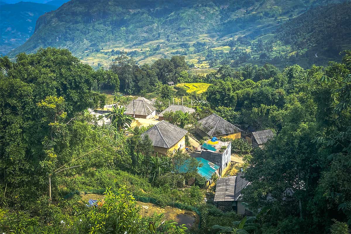
Lao Chai village
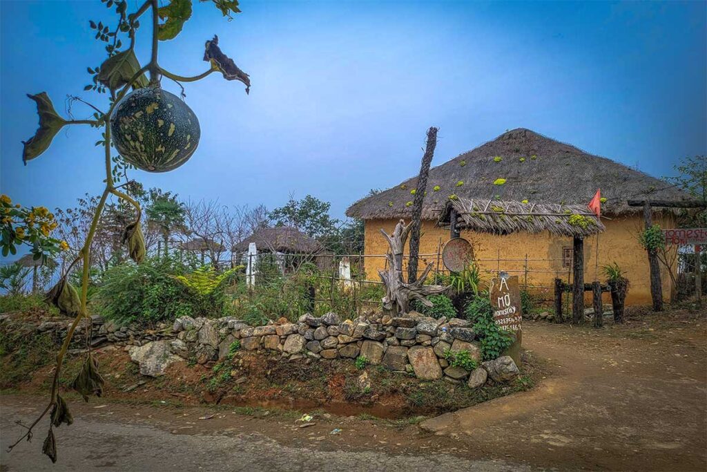
Lao Chai (not to be confused with the eponymous village closer to Sapa) is the village with the highest number of Ha Nhi people in Y Ty with 76 households and is also the most attractive destination to visit. The name “Lao Chai” means “original village” and “old village” because this is the first village with 100% Black Ha Nhi people.
The first thing to see are the walls and thatched roofed houses of the Ha Nhi people. The walls are made of thick earth, the sloping short roofs are covered with grass, but it is very sturdy and gives a warm feeling in the winter and cool in the summer. Seen from above, these houses look like giant mushrooms.
In addition to the unique architecture of the houses, you will also find a friendly, hospitable atmosphere. Also striking is the traditional costumes of Ha Nhi women. The most striking feature is the wig and headscarf. The wig is made of wool to form a large bundle that keeps the head warm all year round in bad weather.
Hong Ngai village
The hamlet of Hong Ngai is the furthest village of Y Ty Municipality, at the end of the Lao Cai border, at an altitude of nearly 2000m above sea level. The whole village has just over 50 households, all of them Hmonh people. Although it is a remote village in Y Ty municipality, the Hong Ngai people have a relatively good life as this is a village with a lot of cardamom, a high quality agricultural product.
Sim San village
Sim San is a village 10 km from the center of the municipality of Y Ty. The whole village has about 100 households. People’s lives mainly depend on rice and maize cultivation. Because the terrain is at an altitude of more than 2000m above sea level with an average temperature in the year of 15C to 20C, there is only one crop per year. They also make their own wine named after the village, namely Sim San wine.
Phan Can Su village
It is one of the two highest villages in the Y Ty border area, about 6 km from the center of the municipality with many slopes. From Phan Can Su you can see the beautiful landscape of Y Ty.
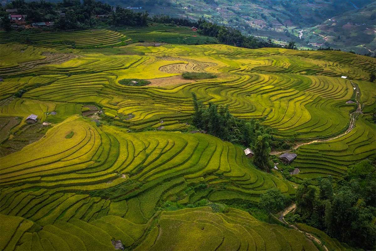
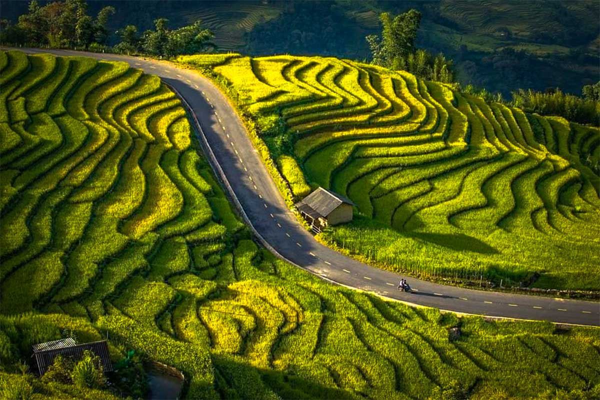
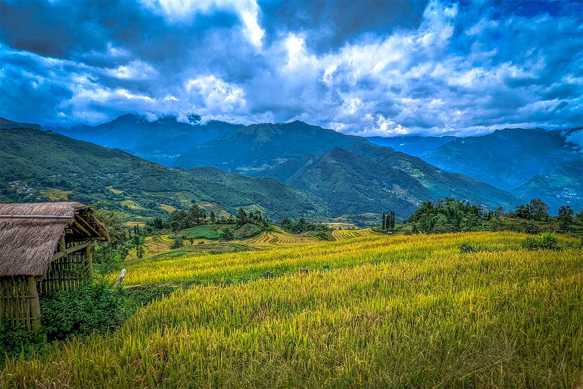
Rice fields of Y Ty
This region is known for the beautiful rice terraces that lie high in the mountains. In recent years, the government and the people of Y Ty have also expanded the medicinal plant production area to improve the economy for the mostly poor population who live here. In addition to traditional crops such as maize and rice, medicinal plants provide a higher economic efficiency.
Den Sang
Den Sang is about 10 km from the center of Y Ty. If you want to see the bright color during the harvest season, the terraced fields here have the most the golden yellow color of the entire province according to the locals. This is because it is transplanted here with local rice varieties, so the color is very yellow. Den Sang terraces are easy to see and photograph as they are located right on the road to Y Ty where the locals are very welcoming and ready to model for tourists to take pictures.
Thau Pa valley
The Thau Pa valley has thousands of terraced and winding fields, stretching for 5 km from Cho Chon to Thien Sinh. This is a recognized national monument. These terraced fields here are mainly worked by the Ha Nhi and Mong people.
Y Ty market
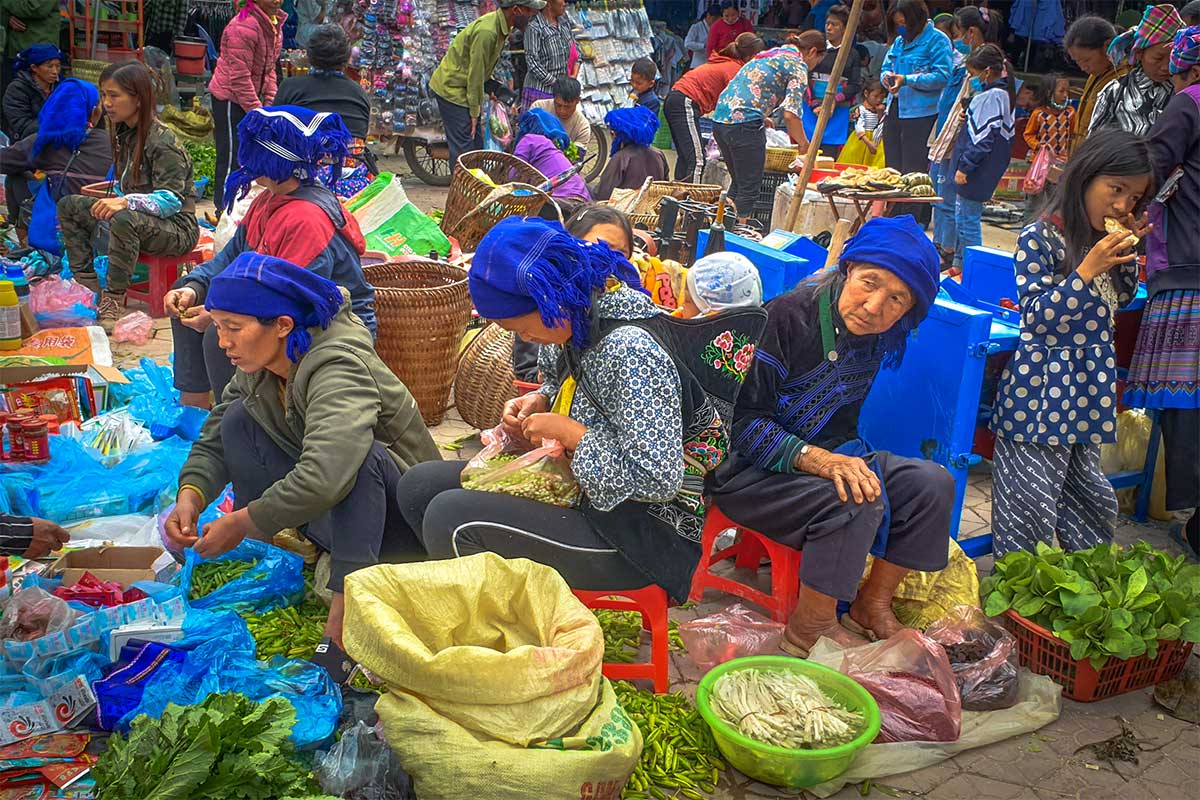
The Y Ty market usually takes place every Saturday. In this market there are many kinds of vegetables, tubers, fruits grown by the ethnic minorities here. In addition to traditional agricultural products, Y Ty Fair also has many consumer goods such as clothing, homeware, plows and hoes. This is not only a place to exchange goods, but also a place for boys and girls dressed in their finest costumes to meet.
Lao Than peak
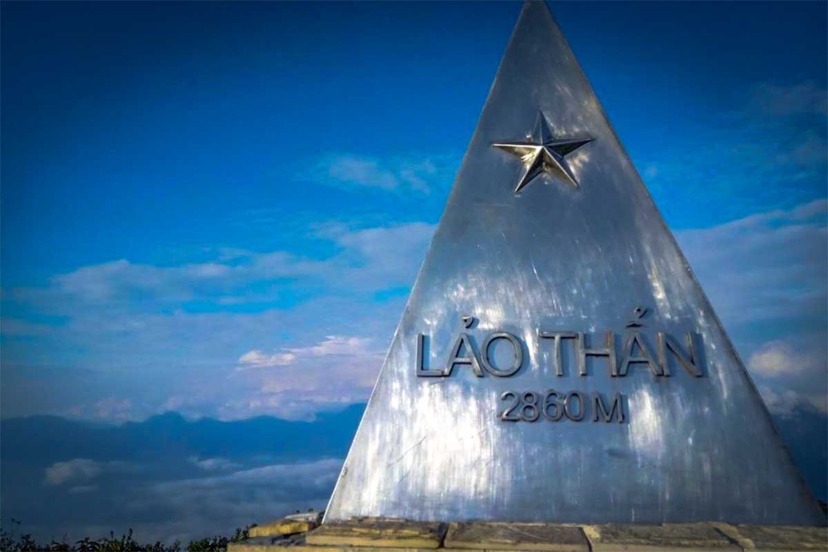
Located at an altitude of 2,860 m, Lao Than peak is considered the roof of the Y Ty area with a magical landscape where the clouds, sun and wind come together in a spectacular way. On the way to the top of this pyramid-shaped mountain you will see friendly ethnic Ha Nhi people with their traditional blue scarf picking up medicinal leaves in the forest.
Best time to visit
- If you want to see the rice fields in full glory with golden colors, it is best to come in the harvest season. It is the same as the best time to visit Sapa, namely in the months September and begin of October; can sometimes start around the end of August.
- The water season, the moment when the rice fields are submerged, so that the entire landscape mirrors the sky is the beginning of May.
- The months between the water season and the harvest season you can see the different stages of the rice growing. The further towards September, the longer and greener the rice is (July / August).
- Y Ty is known for the thick opacus clouds that hang in the valley, making it seem like you are floating above the earth. The best time of year to see these clouds is from September to April.
- In late March and early April, azalea flowers bloom brightly, making the forest of Y Ty colorful.
- There is a chance of snow in the region in late December and early January.
Tip: If you like to participate in the biggest festival of the year of the Ha Nhi people, then you have to go to the Kho gia festival. This festival is held on the first dragon of the sixth month of the lunar calendar. Depending on the year, this is often the end of June or the beginning of July.
Kho gia festival
This is a festival of the Ha Nhi people that lasts 3 days. The festival is about worshiping the agricultural god, forest god, water god and soil god for good harvests, brood development, healthy people, and a good life. The estival is considered the oldest and largest seasonal prayer festival of the black Ha Nhi people.
Kho gia festival starts with an important ritual of sacrificing buffalo to sacrifice spirits. After this ritual, the buffalo meat is distributed to the families in the village to take home for ancestor worship; that the ancestors protect the family and the descendants for a year. The head of the family brings a sacrificial tray of food to the forest for a ceremony, showing their respect and gratitude to the gods. Ha Nhi women make delicious cakes during this festivals.
How to get there?
Y Ty is a municipality in Bat Xat District, Lao Cai Province; this is the same province where Sapa is located. Sapa is about 70 km from Y Ty, but due to the zigzagging roads, this journey can easily take more than 5 hours without stopping. Fortunately nowadays the road to Y Ty has been upgraded, without muddy roads like a few years ago.
From Hanoi to Sapa or Lao Cai
From Hanoi you can take the sleeper train to Lao Cao. In addition, there are also buses and limousine minibuses.
Read a detailed explanation here: From Hanoi to Sapa
From Lao Cai or Sapa to Y Ty
Although only about 70 km from Lao Cai (along Bat Xat – A Lu), the time to get to Y Ty is quite long, about 5-6 hours including time to stop along the way to admire the scenery and take photos to make. The most popular way to get to Y Ty is to rent a motorbike in Lao Cai or rent a motorbike in Sapa. If you don’t want to drive a motorbike, you can rent a car with a driver.
Note: Although a good road has now been built, landslides can occur in the rainy season, which damage the road or mud that makes the road slippery.
Sapa – Y Ty
From Sapa, drive towards the Tram Ton Pass to the junction with the signs Lai Chau and Ban Xeo, then turn right after about 20 km to Ban Xeo (DT155 road on Google Maps). Here is a fork to the Muong Hum market, don’t forget to turn left to go to the market. Via the Muong Hum market there is a road to Y Ty, you just go straight on the DT158 and after about 30 km you will reach Y Ty.
Accommodations
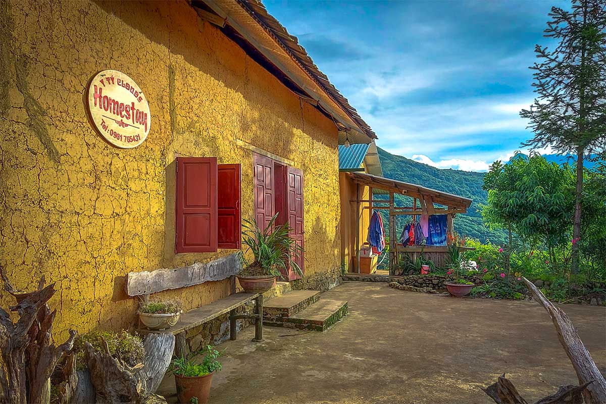
Although not as developed as other locations, Y Ty now has a number of homestays built by the locals to serve tourists. Don’t expect a lot of luxury here, but this is one area you come to for the experience.