
What trekking in north Vietnam is actually like
What you walk through
The north is mountains, and people live in them. That combination is what makes the walking here different from a national park in Europe or the US.
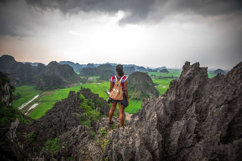
Most routes follow the shape of farming country. You cross terraced valleys on the earth walls between fields, climb through bamboo and forest, drop into a hamlet of stilt houses, then climb the next ridge. Higher up around Sapa and Hoang Su Phi it gets steep and cold and the views open right out. Further east around Ba Be and Cat Ba it is limestone, jungle and water instead of terraces.
Villages are part of the route, not a detour from it. You will pass buffalo on the path, kids walking home from school, and someone repairing a field wall. The people living up here are mostly ethnic minority groups, and the clothing, houses and language change as you move between valleys. That is a large part of why people come.
Do not expect marked trails
This is the thing worth knowing before you book anything. North Vietnam has no real trail network. Almost nothing is signposted, there are no trailhead maps, no waymarked routes, and no mountain rescue. The paths are working farm tracks, and they shift with the seasons. A route that was obvious in April can be overgrown or washed out in August.
Some walking is easy to do alone. Village lanes in the Muong Hoa valley below Sapa, the paths between homestays in Pu Luong, and the marked routes inside national parks like Cuc Phuong and Cat Ba are all fine on your own.
Anything longer, higher or further from a road realistically needs a local guide. Not because it is dangerous, but because the trail is not there in the way you expect, and because a guide is what gets you into villages and homestays where you would otherwise just be a stranger walking through someone’s yard.
Best time for trekking in north Vietnam
Here is the awkward truth: the months with the best walking weather and the months with the best scenery are not the same. Most guides pick one and present it as the answer. You should know both and then decide which matters more to you. If you want the wider weather picture first, the best time to visit north Vietnam covers it season by season.
Best weather for trekking
Two windows stand out: October to early December, and March to May.
Autumn is the better of the two. The rain has stopped, the air is clear, the ground has dried out, and temperatures in the mountains sit comfortably in the high teens and twenties. Visibility is at its best, which matters more than people expect in a landscape built on long views.
Spring is a close second. Warm, mostly dry, and green, though March can be hazy and the far north often sits in low cloud.
The two to think twice about: December to February is genuinely cold above 1,500 metres, with fog that can hide everything for days, and June to August brings heat, humidity, heavy rain, mud, leeches and the occasional landslide.
Best scenery for trekking
Scenery follows the rice, and the rice follows a strict calendar.
In the high valleys there is one crop a year. Flooded terraces in May, green through July and August, gold in September, and bare brown fields from mid October until spring. Lowland areas like Pu Luong get two crops, so they turn gold twice, in late May and again in autumn.
Harvest week is not the only good time. August is the greenest month of the year and the terraces are full from top to bottom, which many people prefer to the gold. The build-up months carry the landscape too. The month-by-month detail is in the north Vietnam rice terraces guide.
The honest compromise
If you want both, aim for late September to mid October.
You still catch gold fields in Mu Cang Chai, Hoang Su Phi and Pu Luong, the rain has largely finished, and the trails are drying out. It is the single best two-week window for trekking here, and it is also the busiest, so book guides and homestays early.
If your dates are fixed and they fall in November, do not cancel. The fields will be empty, but the walking conditions are the best of the year and you will have the trails to yourself.
Best trekking destinations in north Vietnam
Ten places worth walking in, ordered roughly by how easy they are to organise. The first two are where most people should start. The middle group takes more planning and rewards it. The last three are national parks, which is a different kind of walking altogether.
| Destination | Best for | Difficulty | Crowds | Days needed |
|---|---|---|---|---|
| Sapa | Terrace trekking, village stays | Easy to hard | High | 2 to 4 |
| Pu Luong | Easy trekking close to Hanoi | Easy to moderate | Low | 2 to 3 |
| Ha Giang | Getting off the loop on foot | Moderate | Low | 2 to 4 |
| Mu Cang Chai | The most dramatic terraces | Moderate | Medium in harvest | 2 to 3 |
| Hoang Su Phi | Remote, steep terrace country | Moderate to hard | Very low | 3 to 4 |
| Bac Ha | Multi-day village trekking | Moderate | Low | 2 to 3 |
| Ta Xua | Cloud hunting and ridge trekking | Moderate to hard | Low (foreign) | 2 to 3 |
| Ba Be | Jungle, lake and Tay villages | Easy to moderate | Low | 2 |
| Cat Ba | Coastal jungle and viewpoints | Moderate | Medium | 1 to 2 |
| Cuc Phuong | Old forest and wildlife | Easy | Low | 1 to 2 |
1. Sapa
The best trekking in Vietnam, and it is not particularly close. The Muong Hoa valley below Sapa drops in terraces from the town all the way to the river, with Hmong, Dao and Giay villages spread through it, and you can walk village to village for days on end.
The town itself is overbuilt and unattractive. Ignore it. Twenty minutes past the last hotel the landscape takes over completely, and if you walk beyond the standard Lao Chai and Ta Van route you lose the crowds almost entirely.
Everything is available here: half-day walks, two-day treks with a homestay night, and harder routes over the ridges. Fansipan is the other draw. The cable car takes fifteen minutes and is fine if you only want the summit. The two-day climb is a real trek and worth it if you want the walking. More detail in the trekking in Sapa guide.
Tip: Trek Sapa with Local Vietnam
Our Sapa trekking tours run with guides who live in the Muong Hoa valley and route around the busy sections. Trips can be day walks or multi-day with homestay nights, adjusted to your pace.
2. Pu Luong
The easiest good trekking in the north, and the closest to Hanoi at around four hours. Pu Luong is a nature reserve of limestone hills, bamboo forest, Thai and Muong villages and terraces cascading down the valley sides, with old wooden water wheels still turning in the streams.
The walking is gentle by northern standards. Most routes are two to five hours between villages, with plenty of flat sections, so it works for people who would not describe themselves as hikers.
Accommodation is the other advantage. Pu Luong has the best range in the north, from basic family homestays to hillside lodges with pools looking straight over the fields, which makes it easy to walk all day and still sleep well. Route detail is in the Pu Luong trekking guide.
Tip: Trek Pu Luong with Local Vietnam
Our Pu Luong trekking tours combine village trails, rice terraces and homestay nights with local guides from the reserve. Easy to moderate routes, suitable for families and first-time trekkers.
3. Ha Giang
Almost everybody experiences Ha Giang (now part of Tuyen Quang province) from a motorbike seat. That is a shame, because walking is where this place actually opens up.
The Ha Giang loop is a road, and roads only reach so far. Step off it and you are into valleys and hamlets that see no tourists at all, where the limestone landscape is at its strangest and the villages have not adapted to visitors in any way. The Du Gia and Bao Lac areas in the south have the greenest terrain and the best walking.
The catch is organisation. There are far fewer trekking operators here than in Sapa, and English-speaking guides are limited, so this is not something to arrange the night before. Details on what is possible are in the trekking in Ha Giang guide.
Tip: Walk Ha Giang from Aya Lodge
Trekking here is easiest arranged from a base, and Ha Giang Aya Lodge sits in a valley with village trails leading straight from the door. Guided walks are organised locally, from short village loops to full days in the hills.
4. Mu Cang Chai
The most dramatic terraces in the country, and walking through them beats photographing them from the pass. The valley between Mu Cang Chai and Tu Le is carved into thousands of steps, and the trails run between fields and up to Hmong hamlets on the higher slopes.
Trekking infrastructure is thinner than in Sapa. There are homestays and there are guides, but fewer of them, and less English. Arrange it in advance rather than on arrival.
Timing matters more here than anywhere. Outside the green and gold months the terraces are bare, and Mu Cang Chai has less to offer than Sapa when the fields are empty. During harvest the main viewpoints on the Khau Pha pass get busy, but the trails a valley over stay quiet.
Tip: See Mu Cang Chai with Local Vietnam
Our Mu Cang Chai tours cover the terraces on foot as well as by road, with local guides and homestay nights in Hmong villages. Trips are timed around what the fields are actually doing that week.
5. Hoang Su Phi
The most demanding of the terrace destinations, and the emptiest. Hoang Su Phi sits below Tay Con Linh mountain in western Ha Giang, where the terraces climb higher and steeper than anywhere else and often disappear into cloud.
Trekking here is proper uphill work. Long climbs between Dao, Nung and La Chi villages, rough ground, and weather that changes fast. Accommodation is basic homestays, not lodges.
English-speaking guides are the real bottleneck. There are few, and in harvest season they are booked out, so plan weeks ahead rather than days. Do it right and you get some of the finest terrace country in Asia with almost nobody else on the trail.
Tip: Trek Hoang Su Phi with Local Vietnam
Hoang Su Phi needs arranging in advance, and we handle guides, homestays and transfers from Hanoi. Routes are built around your fitness, from valley walks to multi-day village crossings.
6. Bac Ha
Two hours east of Sapa and a completely different atmosphere. Bac Ha is Flower Hmong country, known for its Sunday market, and it has quietly become one of the better multi-day trekking areas in the north.
The routes run village to village through terraces, forest and corn fields, climbing gradually from one settlement to the next. It is real walking, four to six hours a day, with homestay nights along the way.
The town is nothing special. The trekking around it is, and there are established guides and homestays, which is what separates Bac Ha from the many scenic places in the north where nothing is organised. Easy to add on to a Sapa trip since they share the same railway line and road.
7. Ta Xua
The one destination on this list that Vietnamese travellers know far better than foreigners do. Ta Xua sits high in Son La at around 1,500 metres, and the reason people come is cloud. On clear winter mornings the valleys below fill completely and you stand above a solid white sea with ridges poking through it.
There are two different trips here and they get confused constantly. The first is the village and viewpoint side around Ta Xua town, with the famous dinosaur spine ridge and the lone tree. That is short walking, an hour or two, mostly about being in the right place at sunrise.
The second is Ta Xua peak, which is a serious multi-day trek to 2,865 metres over on the Yen Bai side, usually started from Tram Tau. Steep, long, cold at the top, and one of the best ridge walks in Vietnam. Local guides and porters run it regularly, so it is well organised, though almost entirely for a Vietnamese market.
Around the villages you also walk through ancient shan tuyet tea trees and Hmong hamlets, which most cloud hunters skip entirely. Cloud season runs roughly November to April, which is the opposite of the rice calendar, so Ta Xua fills the months when the terraces are bare.
Tip: Visit Ta Xua with Local Vietnam
Ta Xua is awkward to reach and easy to time badly, so it pays to have it arranged. We handle transport, homestays and guides, whether you want a sunrise above the clouds or the full peak trek.
8. Ba Be National Park
Jungle, lake and limestone instead of rice terraces. Ba Be is built around the largest natural lake in Vietnam, with forested karst rising straight out of the water and Tay villages on stilts along the shore.
The walking is easy to moderate: forest trails, caves, waterfalls and village paths, usually combined with a boat trip on the lake, which is the best way to see the place. Guides are arranged locally through the homestays.
It is quiet, even in high season, partly because it takes around six hours from Hanoi. Good option if you want nature and water rather than mountains. Route options are in the Ba Be trekking guide.
Tip: Visit Ba Be with Local Vietnam
Our Ba Be Lake tours combine forest walks, cave visits and a boat trip with a night in a Tay stilt house homestay. It works as a two-day add-on from Hanoi or as part of a wider northeast route.
9. Cat Ba National Park
The only coastal trekking on this list. Cat Ba island sits in the Halong Bay area, and its national park covers thick jungle on limestone, with routes up to the Ngu Lam viewpoint and the longer traverse to Viet Hai village.
Be realistic about the conditions. It is hot, humid and steeper than it looks, the rock is sharp and slippery, and the longer trail is rough in places. The short viewpoint climb takes about an hour and suits most people. The Viet Hai route is a half day and needs proper shoes.
It combines well with time on the water, and kayaking around Cat Ba is the natural pairing with a morning in the forest.
Tip: Explore Cat Ba with Local Vietnam
Cat Ba works well as a two or three day stop combining jungle walks, kayaking and a quieter version of Halong Bay. We arrange guides, boats and transfers from Hanoi or Haiphong.
10. Cuc Phuong National Park
Vietnam’s oldest national park, and the one you visit for forest rather than views. Cuc Phuong is old-growth jungle with huge buttressed trees, and the draw here is wildlife and the primate rescue centre rather than scenery.
Trails are marked, which makes it one of the few places in the north you can walk properly on your own. The ancient tree route is the main one, around six kilometres each way, and it gets very muddy after rain.
It is easy, close to Hanoi and to Ninh Binh, and good with children. Skip it if you are looking for mountain landscapes, because you will spend the day under canopy.
What did not make the list
A few well-known names are missing on purpose. Ninh Binh and Mai Chau are flat, and both are far better by bicycle than on foot. Y Ty has scenery on the level of Sapa but almost nothing organised for trekkers. Ngoc Chien has good terrain and homestays, but no real guiding set-up in English, so it works for experienced travellers with a local contact and not much better than that.
Practical tips for trekking in north Vietnam
On your own or with a guide
Some walking here is fine alone. The village lanes in the Muong Hoa valley below Sapa are obvious and busy enough that you cannot really get lost. The paths between homestays in Pu Luong are the same. National parks like Cuc Phuong and Cat Ba have marked routes, which makes them the easiest places in the north to walk independently.
Beyond that, take a guide. Not for safety reasons alone, but because the trail often does not exist in the form you expect and because a guide gets you into villages and homestays that are otherwise closed to you. A good local guide also translates, which changes the day completely.
Day hikes or multi-day treks
A day hike usually means three to six hours of walking with a lunch stop in a village, returning to your hotel at night. Easy to arrange, easy to fit into a wider trip, and enough to see the landscape properly.
Multi-day trekking is where the north gets interesting. You walk from village to village, four to six hours a day, and sleep in a homestay along the way.
Set your expectations for those nights. A mattress on a wooden floor, a mosquito net, a shared bathroom that may be cold water only, dinner cooked by the family and eaten together, and rice wine that is hard to refuse politely. Basic, not uncomfortable, and usually the part people remember most.
What to pack
The footwear question comes up constantly. If you are doing one or two trekking days inside a three-week Vietnam trip, you do not need heavy boots. Trail shoes or trainers with real grip are enough, as long as the sole is not smooth. Bring proper boots only for multi-day treks in wet months or for peaks like Fansipan and Ta Xua.
- Shoes with grip you do not mind ruining, plus sandals for the evening
- Layers. Mornings above 1,500 metres are cold even in summer
- Rain jacket rather than an umbrella
- Long trousers and long socks for wet months, which help against leeches
- Small daypack, one to two litres of water, and snacks
- Cash in small notes. No ATMs in the villages
- Headtorch, basic first aid, blister plasters
- Sun protection. The high valleys burn you faster than you expect
- Power bank, since homestay electricity can be unreliable
More general advice is in the Vietnam packing list.
Planning and preparation
Download offline maps before you leave Hanoi. Mobile coverage is patchy in the valleys and gone entirely on the ridges, and Google Maps is unreliable for footpaths here in any case. An offline translation app matters just as much, because in the villages you are often dealing with people who speak neither English nor much Vietnamese. Both are covered in the apps worth having for a Vietnam trip.
A few other things. Get a local eSIM or SIM card on arrival, since coverage from Vietnamese networks beats roaming. Tell your homestay or hotel your route and expected return time if you are walking alone. Book guides and homestays weeks ahead for late September and October. And check that your travel insurance actually covers trekking, because some policies exclude it above a set altitude.
Safety and difficulty
Difficulty ratings here are not the same as in Europe or the US. An “easy” route can still mean a slippery earth path along the edge of a terrace with a drop on one side and no handrail anywhere.
The real risks are ordinary ones. Loose rock, wet mud, and steep descents cause almost all the injuries. Buffalo on narrow paths deserve respect, village dogs bark more than they bite, and leeches in the wet season are unpleasant but harmless.
Understand what remote means here. There is no mountain rescue, phone signal disappears, and the nearest hospital can be several hours of mountain road away. Walking with a guide solves most of this, because they know the way out.
Respect the villages you walk through
You are crossing people’s land and homes, not a park. A few things matter:
- Stay off the terraces themselves. The earth walls break easily, and a broken wall drains the field and the ones below it
- Ask before photographing anyone up close. Hold up your camera and wait for a nod, since most people will not speak English
- Do not enter houses or courtyards without being invited. Ask and you will often be welcomed in
- Skip the sweets and money for children. It keeps kids off the path to school and turns visitors into a source of handouts
- Spend locally instead. Sleeping, eating and hiring guides in the village is what actually helps
- Cover your shoulders and knees when you are inside someone’s home, and follow your host on shoes on or off
Trekking in the rainy season
June to September is wet, and it does not stop trekking. It changes it.
The rain usually arrives in heavy bursts rather than falling all day, often in the afternoon or overnight, so mornings are frequently clear. Starting early is the single best adjustment you can make.
What rain really affects is the ground and the roads. Paths turn to mud, stream crossings rise, leeches appear, and mountain roads to places like Hoang Su Phi can be blocked by small landslides. Build in buffer days and do not schedule a flight for the evening you come down from the mountains. The upside is that the landscape is at its greenest and the trails are empty. There is more on what to expect in the north Vietnam rainy season guide.
The north is not the only place to trek in Vietnam
The north has the terraces, the ethnic minority villages and the highest mountains, so it takes most of the attention. It is not the only option.
The central highlands around Dalat have pine forest and waterfalls, Phong Nha has serious cave and jungle expeditions, and Cat Tien in the south is about wildlife rather than views. Different landscapes, different seasons, and useful to know if your trip does not go north at all. The full picture is in the trekking in Vietnam guide.